
Baltic Earth Observation and Geodata Repository und Atlas of Fragmented Transformations
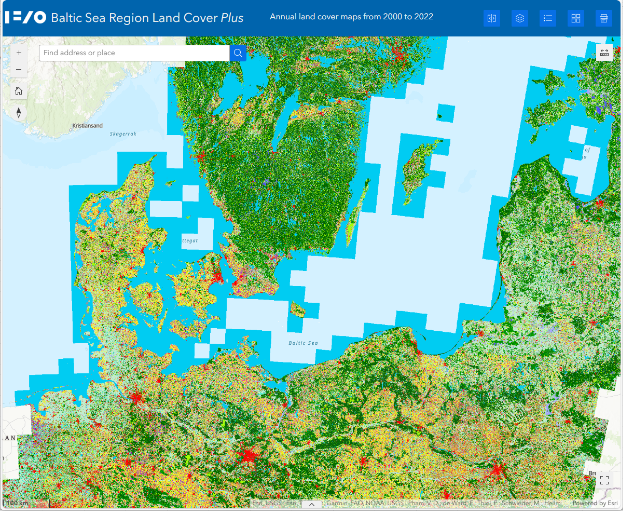
The aim of Work Package 2, Baltic Earth Observation and Geodata Repository & Atlas of Fragmented Transformations, is to prepare the advanced and new data products of Work Package 1 Spatio-temporal Patterns of Land Cover and Land Use in such a way that they are easily accessible in terms of technology and content to scientists from less quantitative or IT-related disciplines, and to operationalize this preparation and provision. With the same goal in mind, further sources of geodata are to be systematically made available in order to provide a comprehensive database with data sources from a wide variety of origins and topics, harmonized in the IFZO Geoportal(formerly Baltic Earth Observation and Geodata Repository). Another focus here is on the goal of integrating historical maps in order to extend the period covered by satellite data.
Link to data product on IFZO Geoportal
Publications
Pham VD, F de Waard, F Thiel, B Bobertz, C Hellmann, DV Nguyen, Beer F, Arasumani M, Schwieder M, Hartleib J, Frantz D, van der Linden S (2024). An annual land cover dataset for the Baltic Sea Region with crop types and peat bogs at 30 m from 2000 to 2022. Scientific Data 11 (1), 1242
People
Bernd Bobertz, Vu Dong Pham (since 02/2025), Sebastian van der Linden (PI), Jörg Hartleib (associated), Peter Stoll (associated)